Gojal: Where Pakistan begins
It’s the second week of November. There is a tremendous silence around me; snowflakes fall gently from the sky. The day is so white — there’s no color in sight save for my red jeep and gray jacket, all other colors have become invisible under the thick snow.
There is neither a military check post, nor any signs of civilian settlement here. This is the Pak-China border, and I am standing at the Khunjerab Pass, with my face towards Pakistan’s brother, China.

The Pakistani segment of the Karakoram Highway, which is also dubbed as the eight wonder of the world, ends here. From here, this highway goes through the bluish waters of the Karakul Lake, settlements of nomads, and through the areas harbouring wild mountainous camels with two humps, and finally ends at Kashgar.
From here, a road leads to Yarkand, and another leads to the Taklamakan Desert, which is the world’s second largest desert, with shifting sand dunes.
The border is protected with barbed wires. As I stand, a flock of sheep appears in sight, moving aimlessly, and then entering the Chinese territory for grazing. The sheep stop by the grass, covered with tiny snowballs, sniff it, and move ahead instantly as if expressing dislike. There is no herdsman with the flock, which is usual in the northern areas. The birds and animals have no borders, but I have to return from this point.
My next destination is Attabad Lake in Hunza.
Among the blackish and forsaken mountains of Karakoram, there is this lake, which came into being purely by chance, it is one of Pakistan’s biggest fresh water reservoirs. This 22-kilometer long and 220-feet deep lake is filled with the blue waters of River Hunza, when a landslide in 2010 blocked its flow, creating a landslide dam. Strong winds in this narrow mountain pass create ripples in the blue-green water of the lake.
With the creation of this lake, more than 18 kilometers of the Karakoram Highway has been submerged, lost somewhere in the depths, suspending transportation by road. Now, the only option is to cross the lake, reach the Hussaini Village, and get on the Karakoram Highway again.
The lake is terrifying. Not only did it drown several villages and people, but it has also affected trade with China. Now, the lake has its own ‘traffic’, boats, big and small, which transport humans, vehicles, and goods from here to there. The sailors are happy with the money oozing out of their pockets. The disaster has proven to be a tragedy for some, and a blessing for others.


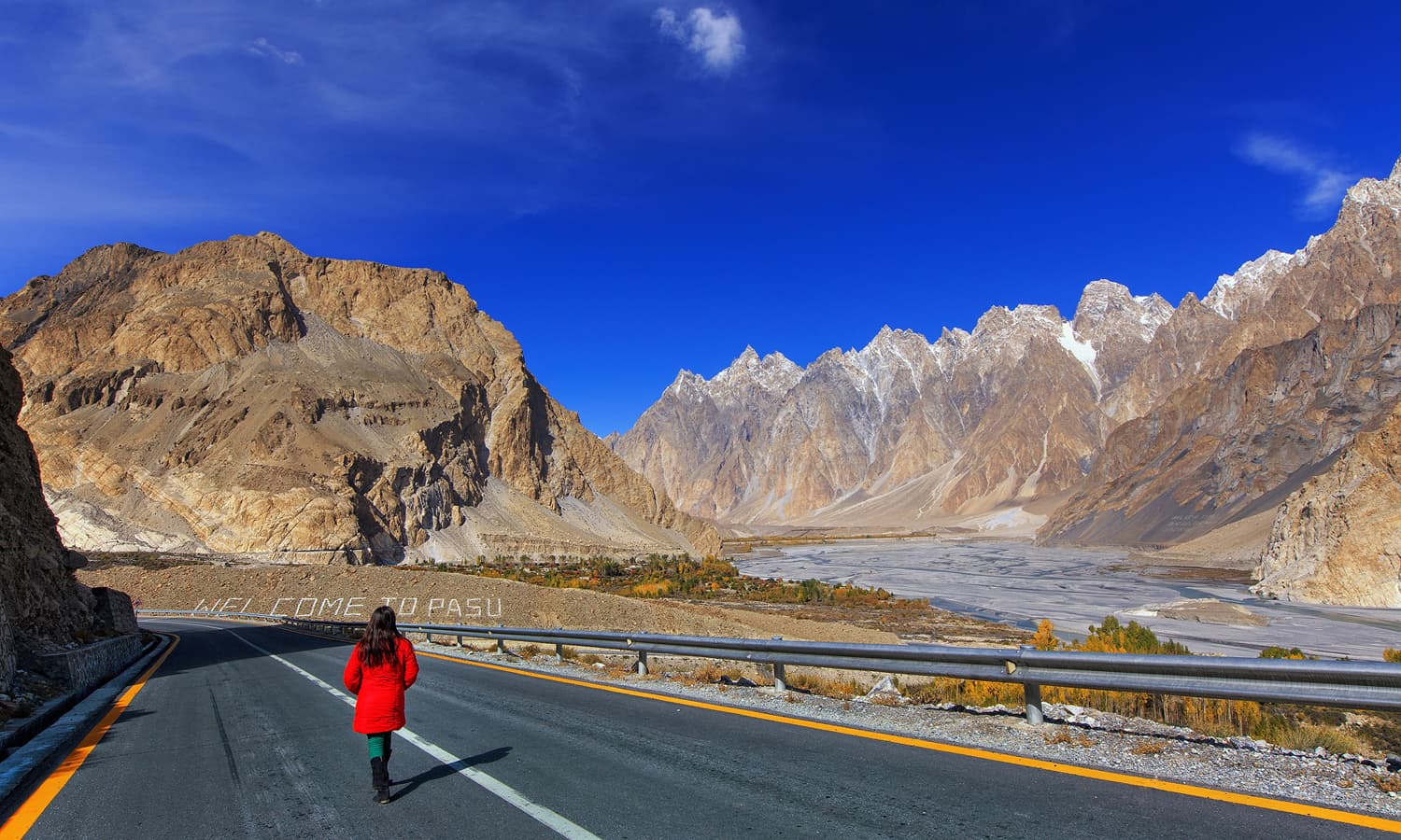
As the boat is fully loaded, the sailor lifts the anchor. You couldn’t hear the person next to you in the terrible noise of engine, so everyone is involved in himself. The journey is 45 minutes long. As the boat makes a sharp turn, I see Passu Cones, a series of mountains pointed as nails.
Strong winds rock the boat, my heart easily skips a couple of beats. The sailor observing my face, smiles. I look past him at the Passu Cones, just to not feel the fear, I tell myself. The boat finally reaches the bank, and everyone gets off. The sailors are mostly Pakhtuns, who have come here to earn a living. I had a brief exchange with the sailor. He happened to have sailed in the Kabul River once, now the Attabad Lake is his second home.
I have reached the Hussaini Village. In the bright sunlight, the Passu Cones are bathed in gold.


This entire area is called Upper Hunza or Gojal. The Gojal Valley borders China and Afghanistan, with its border meeting the Chinese border at Khunjerab — 15,397 feet above sea level — and remains covered with snow all year long.
In the north west, there is Chiporsun, whose border touches the Wakhan region of Afghanistan. Wakhan is about six square miles in area, after which starts Tajikistan. The Karakoram Highway which connects Pakistan to China also passes through Gojal Valley and enters China at Khunjerab.


Before 1974, Gojal was part of the Hunza State, and was governed by the Mir of Hunza.
Gojal enjoyed tremendous importance owing to its strategic and agricultural value. The Gulmit Vvillage of Gojal was the summer capital of Hunza, where the Mir of Hunza used to hold his court and deliberations were made on a range of issues. Local music and dance programs would also be organised here, and Polo would be played in the vast rectangular ground in front of the palace.
Mir Muhammad Ghazan Khan, the Mir of Hunza announced an affiliation with Pakistan, but it enjoyed autonomy as a separate state till 1974. In Z. A Bhutto’s tenure, the political reforms brought the so-called fall of Hunza’s princely state. Since then, Gojal is identified as a Tehsil in the subdivision Hunza of Gilgit-Baltistan. Locally, it is also known as Upper Hunza, but in official documents, it is named Gojal.


As I exit the Hussaini Village, I see children crowding the road. Golden hair, blue eyes, and faces so red they could outshine apricots! Riding along the river, I reach Gulmit, Gojal’s most populated village.
It is autumn, and it feels as if the entire village is asleep in the cool afternoon. The blowing wind frees the leaves from trees, and this is the only sound I can hear.
The Passu Cones were in sight constantly. The fields have been harvested, and the farmers are resting in their homes. I pass by a few elderly women, wearing traditional caps, followed by naughty little children. In return to my salutations, I receive countless prayers. When my jeep moved forward, I could see the children waving in my rear view mirror.


Just one kilometer ahead, the Borith Lake appears. There is an old hotel at the bank of the lake, the taste of its food still fresh in my memory. The bank had tall grass; in the backdrop, there stand snow-covered mountains, and their reflection would cast a spectacular white in the murky water. Four waterhens lazily float on surface.
The lake is coloured black, and I feel joyous at the sight of these swamp chickens. But as Mustansar Hussain Tarar says, “What do four waterhens have to do with happiness?”. Happiness comes from somewhere inside. At some point in the past, the lake was home to waterlife and migrating birds, but now the level is reducing and the lake is gradually drying up.
The gang of waterhens flies and vanishes somewhere far away in the mountains. Happiness has nothing to do with them, but I sense my own fled with them. An elderly man came out of the hotel, welcomed me, and said: “Terrorism has badly affected tourism. Not many people visit such faraway lands now. Once in a blue moon there’s a random traveler, who becomes the source of my bread. You must click some nice photographs and show them to the world so that tourism once again gains momentum. Come, I will feed you some great meals.” His sweet bribe made me teary as I smiled at him in response.
A Danish girl approaches me and we start conversing — she is a doctorate student who is doing a thesis on climate changes in the Karakoram Mountain Rrange. She told me that she liked the lake so much, that she had been staying here at the Borith Lake for the past three months.
Then she asked me if I had ever seen the lake on a full moon night. I responded negatively. She insisted, “you won’t that photograph anywhere else.”
My driver and I eat, while she talks. When I am finally about to leave, she says, “Your country is beautiful, do go to the Batura Glacier if you happen to visit the Passu Village, I have seen swans gathering on the white snow of the glacier.”


My driver is astounded by her revelation and tells me. “Sahib, I’ve been living in this area since forever. I have never seen swans on glacier.”
I said, “She must be a passionate nature lover, and such lovers can see even pigeons on glaciers, I too have seen fireflies on the River Chenab”. My driver smiles at my response, and we arrive at Passu.
Darkness is enveloping the valley as our jeep enters the Passu Village. I check-in at a hotel and rest for a while. Then, I go out in the dark to countless stars shining in the sky like jewels. Outside, people have decorated their homes and worship places.
Men, women, children, elders, all walk towards the Jamat Khana for the birth anniversary of their religious leader. The night was cold but the people were out in the streets in high spirits. The sky was decorated with stars, and the homes with lamps.
I see the full moon, intricately placed at the tip of a mountain. I am suddenly reminded of the Danish girl, and her description of the full moon at the Borith Lake.
In the morning, I witness the same joy and fervour as last night. It was just like Eid ul Fitr. Faces filled with happiness, toys in hands, prayers on lips. This autumnal morning of Passu seemed even more beautiful.
My camera is in my bag. I have always felt that one should always avoid taking pictures during local festivals, especially when they are of religious nature. You are a stranger among them, why give them an excuse to object?


I had to leave this beautiful place, even though I really didn't want to. When you are travelling towards Sost from Passu, a jeep road turns to Shimshal. This is a vast area and its borders touch both China and Baltistan.
Pamir is also in the Shimshal Valley. Due to its hard terrain, it was disconnected from rest of the world until a jeep road was built here. The locals have given many sacrifices for the construction of this road.
Shimshal is famous for producing the country's finest mountaineers, including Samina Baig, who is the first Pakistani woman to have climbed Mount Everest. Shimshal’s Rajab Shah and Meherban Shah have scaled Pakistan’s highest summit. Experienced mountaineers in Pakistan mostly hail from Shimshal.


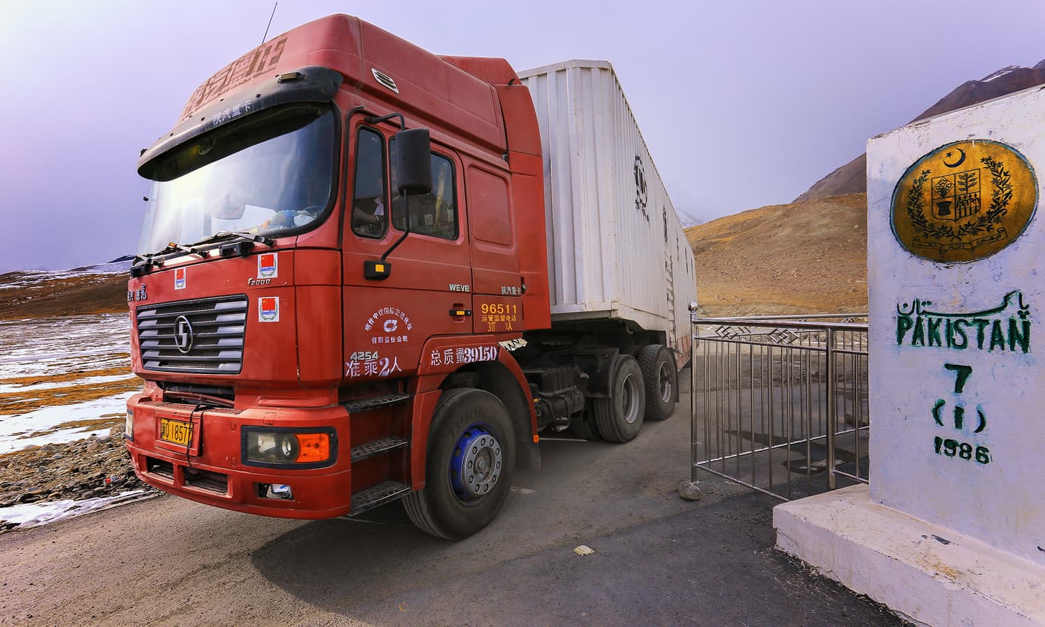
Sost, the last town of Pakistan, is filled with motor workshops. There is no other settlement on the Karakoram Highway when you leave Sost for China. After Sost, there is the Khunjerab Pass at 15,397 feet above sea level, where China and Pakistan’s border is located. Apart from Pakistan Customs office, there’s a dry port in Sost, where goods to and from China are stored.
A large number of traders and labourers from different areas of Pakistan dwell here, which has given rise to economic activities more than other places in the region. After Sost, a jeep road turns to the Chiporsun Valley. It’s northwestern part is connected to Afghanistan’s Wakhan area through the Irshad Pass.
Ahead of Sost is Khunjerab, which is the last Pakistani territory. The name actually is combination of two words Khun (blood), and Yeraf (glacial stream), and literally translates to 'Stream of Blood'.
It is said that an ancient psychic had once prophesied that a battle would be fought here, and that the bloodshed would be so great that the horse riders’ feet would be dripping with blood. Thus, the area is named so. This region is home to several rare species, including snow leopards, bears, and the golden eagle.


At Khunjerab, the snowfall is constant, enveloping streams, springs, roads, mountains, everything. I raise my head to look at the sky, soon my eyelashes are covered with snow. As I wipe my eyes, my driver states: “Sahib, Pakistan ends here, let’s go back home.”
He turns our jeep around, and I say to him: “Sharif, Pakistan doesn’t end, it begins here.” On my right hand, there is a sign which reads “Welcome to Pakistan.”

Translated by Bilal Karim Mughal from the original in Urdu here.

Syed Mehdi Bukhari is a Network Engineer by profession, and a traveler, poet, photographer and writer by passion.
He can be reached on Facebook.


