ON June 3, 2024, Karachi experienced a 3.2 magnitude earthquake, a stark reminder of the city’s persistent and potentially increasing seismic hazards. Earlier, on April 24, a quake of similar magnitude struck the area of Malir in Karachi.
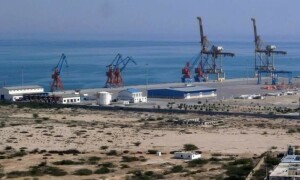
The city is situated on one major seismic fault line and close to four minor faults. The Allah Bund fault, the major fault, runs parallel to Sindh’s coastal belt, extending to Gujarat, India, and passing through the area around Pakistan Steel Mills and the area in District East. Another fault lies in the Rann of Kutch; the Pubb fault is located near the Makran coast west of the city; and a fourth fault runs through Dadu district on Karachi’s northern boundary. Additionally, the triple junction of the Indian, Arabian, and Eurasian tectonic plates is only 150 nautical miles northwest, making the entire Makran coast, including Gwadar, vulnerable.
The history of earthquakes along Sindh’s coastal belts, including Karachi and the Makran coast, is marked by significant seismic events that have caused extensive damage and loss of life. Historical records and scientific sources show that a massive earthquake, measuring 7.5, struck the Debal port east of Karachi in the ninth century, killing thousands. The jolt caused the Indus river to change its course.
In 1668, a quake of 7.6 magnitude hit the Auranga port near present-day Shah Bundar, submerging a large portion of the area. Due to increased trade thanks to the activities of the East India Company, the Portuguese, and the Dutch, Mughal Prince Aurangzeb Alamgir, who was then the governor of Multan, had commissioned this additional port to complement the primary Lahari port. This port had started working from 1652.
Recent tremors in Karachi are a reminder of seismic risks.
On June 16, 1819, a 7.5 magnitude earthquake struck Sindhri port on the Pakistan-India border in present-day Badin district, killing over 1,500 people and raising a 90-kilometre stretch of land by 4.3 metres. The tremor was strongly felt in Hyderabad in Sindh. In November 1945, an earthquake and subsequent tsunami devastated the Makran coast, killing over 4,000 people. The epicentre was 408 km west of Karachi. The tsunami generated high waves of up to 12m, destroying a fishing village and causing the waters to rise up to 2m in Karachi. A tsunami also hit Mumbai, washing away 15 people.
The 2001 Gujarat earthquake, which claimed thousands of lives in India, was also strongly felt in Karachi and Hyderabad. Karachi, located just 378 km from the quake’s epicentre, experienced significant tremors. Since 1900, Karachi has been directly hit by 24 earthquakes with magnitudes above 3.0 and up to 5.2 on the Richter scale.
Moreover, Karachi’s capacity to absorb seismic shocks has diminished due to extensive and haphazard urban development. Gizri Creek, once one of the main creeks, has become a housing settlement, leaving Korangi Creek as the only remaining waterway. Sub-creeks of Korangi Creek have been converted into golf clubs and DHAs, ignoring the hazards of disrupting the marine ecosystem. Obhayo, once Karachi’s largest lagoon starting from what was then Kemari Island, has been overtaken by housing settlements and installations like Hijrat Colony, Shireen Jinnah Colony, the Mai Kolachi Bridge, and the areas of Do Talwar and Teen Talwar. It is now reduced to a polluted pond known as Boat Basin.
The construction of the Mai Kolachi Bridge severed the lagoon from the open sea, disrupting a vital marine function. Similarly, the disconnection of the Nai Naar lagoon at Sandspit in the 1950s ended the natural tide cycle that once cleansed Kemari harbour. The flash flood thrust during monsoon in the city’s narrowing two rivers can also create a local seismic activity because of chocked outflows to the sea.
Karachi’s population has skyrocketed from four million in 1980 to over 20m now, leading to unplanned expansion and the proliferation of poorly constructed buildings. Urgent measures are needed to restore Karachi’s marine ecosystem and improve disaster resilience. Undoing the damage is a herculean, near impossible task but that does not mean the whole city should continue to be at risk. The rapidly growing trend of high-rise buildings, and many on reclaimed land facing the open sea calls for serious government intervention. Failure to address these issues could endanger the lives of millions of people and disrupt a vital commercial hub as both ports are exposed and one of them lies right on the Allah Bund fault.
The writer is an expert on climate change and sustainable development and founder of the Clifton Urban Forest.
mlohar@gmail.com
X: masoodlohar
Published in Dawn, June 17th, 2024


Dear visitor, the comments section is undergoing an overhaul and will return soon.